

MARQUETTE, Mich. — Michigan Department of Natural Resources firefighters are contending with more than flames as they work to contain three wildfires burning across the Upper Peninsula.
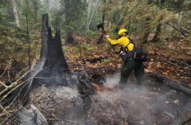
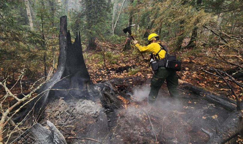
Sixty-five DNR firefighters continued suppression efforts Thursday on the Ridge and Craig Lake fires, facing rough terrain, falling trees, slippery rocks and rutted roads that are sometimes too muddy to travel.
“Firefighter safety is a top priority at all times,” said Nate Stearns, DNR incident commander. “We are specially trained to watch out for hazards, risks and one another, and how we’re approaching these fires is no different.”
Rain helps, but creates new problems
Recent precipitation has reduced fire behavior, but it has also made rocks slippery and soils softer, making it harder for heavy equipment to reach the fires and more likely to get stuck.
Drought conditions across the Upper Peninsula mean the fires are burning as deep as 2 feet in the duff layer, the partially decayed organic matter that sits beneath the loose leaf litter and above mineral soil. Because of that depth, rain alone does not put the fires out.
The underground burning can also destroy the root systems of trees that still look healthy and green, causing them to fall without warning. High wind gusts expected Thursday and Friday raise the risk of falling trees.
Fire status
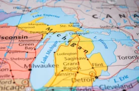
The Ridge Fire is estimated at 466 acres and 30% contained. It is located about 10 miles northwest of Marquette, north of the Dead River Basin and west of County Road 510. A DNR pilot spotted it Oct. 9, and the cause remains under investigation.
The Craig Lake Fire, north of Craig Lake State Park between Baraga and Marquette, is estimated at 606 acres and 57% contained. A DNR pilot detected it Oct. 8, and the DNR has confirmed lightning as the cause.
A 20-person DNR Incident Management Team is managing both fires. Support is coming from the U.S. Forest Service, Michigan State Police, the Marquette County Sheriff’s Office and Emergency Management, the Marquette National Weather Service, Baraga County Emergency Management, the Michigamme-Spurr Fire Department and the DNR Law Enforcement Division.
Black River Fire
In the western U.P., about 4 miles south of Wakefield, 60 personnel worked Thursday on the Black River Fire, which is estimated at roughly 382 acres and 50% contained.
Crews have built bulldozer lines along portions of the southern perimeter. Hand crews are working portions of the northern and southern perimeters where soil conditions limit heavy equipment access.
Agencies assisting include the U.S. Wildland Fire Service, Keweenaw Bay Indian Community, Bay Mills Indian Community, the Marquette National Weather Service, Gogebic County Sheriff’s Office and Emergency Management, the Minnesota and Wisconsin departments of natural resources, the Bessemer Township and Wakefield local fire departments, and the U.S. Forest Service’s Ottawa National Forest.
Evacuation status, flight restrictions and closures
Residents along North Basin Drive remain at the “Ready” status under the DNR’s “Ready, Set, Go!” protocol. Officials encourage them to stay prepared in case conditions change.

- MSP Sergeant Receives 2026 Negotiator of the Year Award - October 16, 2026
- Michigan DNR firefighters continue to battle hazardous conditions as UP wildfires continue - October 16, 2026
- 10 races to watch: Democrats, Republicans battle for Michigan Legislature - October 16, 2026